
At a glance
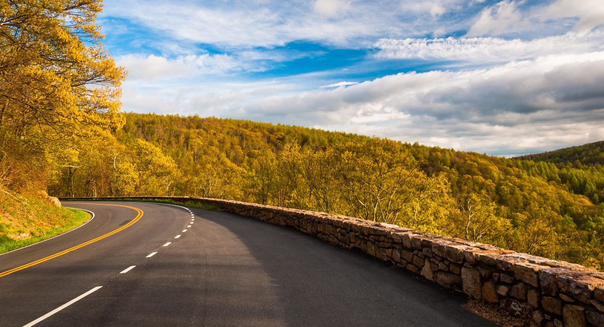
Skyline Drive (105 miles, Shenandoah) connects directly to the Blue Ridge Parkway (469 miles) at Rockfish Gap — 574 miles of connected scenic road. Virginia's roughly 320-mile stretch has just one tunnel (Bluff Mountain, 13 ft 1 in edge clearance); 25 of the Parkway's 26 tunnels are in North Carolina. Twelve NPS campgrounds line the two roads, all $30/night, all dry camping (no hookups); two Parkway campgrounds, Linville Falls and Crabtree Falls, are closed for the 2026 season. Shenandoah campgrounds open spring through fall; Parkway campgrounds run late May through late October. Big Meadows (221 sites) is the most popular and reservation-only. Fuel: one station on Skyline Drive (Big Meadows Wayside, seasonal) and none on the Parkway — plan stops at exit towns. Speed limits: 35 mph on most of Skyline Drive, 45 mph maximum on the Parkway. Fall color starts at high elevations in late September and works downhill through October. As of October 20, 2026, Parkway mileposts 344-355 in North Carolina remain closed for Hurricane Helene repairs. Pick up near DC in Arlington or Richmond.
Why do these two roads belong in the same RV trip?
The moment you cross from Skyline Drive onto the Blue Ridge Parkway at Rockfish Gap, very little changes except the speed limit — 35 bumps to 45. Same ridgeline, same views, same two-lane road hugging the crest of the Blue Ridge Mountains. RVers we talk to often plan this as one long drive and only notice the handoff when the speed limit sign changes. Most people don't realize these are two separate park units managed by two different NPS offices. From your driver's seat, it feels like one continuous drive.
Combined, they form 574 miles of scenic ridgeline road — one of the longest connected scenic drives in the eastern U.S. Shenandoah's Skyline Drive runs 105 miles through the park from Front Royal to Rockfish Gap, where the Blue Ridge Parkway picks up and continues 469 miles south to Cherokee, North Carolina. Four campgrounds line Skyline Drive. Eight more sit along the Parkway. That's twelve NPS campgrounds across one connected route, and every one charges $30 per night. In 2026, ten of them are operating; Linville Falls and Crabtree Falls on the Parkway are closed for the season.
Here's the detail that matters for RV planning: Virginia's roughly 320-mile stretch — all of Skyline Drive plus the first 216 miles of the Blue Ridge Parkway — has only two tunnels, one on each road. Skyline Drive's Mary's Rock Tunnel clears 12 feet 8 inches, and the Parkway's Bluff Mountain Tunnel (milepost 53.1) clears 13 feet 1 inch at the edge line. The other 25 Parkway tunnels are all in North Carolina. If your rig is tall and you're nervous about clearances, the Virginia section gives you a week or more of driving and camping with just two heights to check.
Which campgrounds work best for RVs along Skyline Drive?
All four Shenandoah campgrounds sit directly on Skyline Drive, spread between mile 22 and mile 79.5. None have hookups — electric, water, or sewer. Every standard site is $30 per night. If you've been camping at parks with 50-amp pedestals and water spigots, this is a different setup.
Big Meadows - mile 51.2
The most popular campground in the park, and it earns it. 221 sites (51 tent-only), with pull-through and deep back-in sites that handle most RVs. Open March 25 through November 29 in 2026, according to the park's operating dates — the longest season of any Shenandoah campground. Showers, laundry, camp store, dump station, flush toilets. Reservation-only through Recreation.gov, and fall weekends book out months ahead. The meadow itself is a broad open clearing near the center of the park where deer graze at dawn and fog settles in the hollows.
Mathews Arm - mile 22.1
Closest campground to the Front Royal (northern) entrance. 165 sites, mix of reservable and first-come-first-served. Dump station, flush toilets, drinking water — but no showers or laundry. A good first-night stop if you're entering from the DC side. Overall Run Falls — the tallest waterfall in the park at 93 feet — starts from a trailhead at the campground.
Loft Mountain - mile 79.5
Southern Shenandoah base. 207 sites (50 tent-only). Showers, laundry, camp store, dump station — the same full amenity set as Big Meadows. Mix of reservable and FCFS sites. Its perch above the valley gives you broad views, and it's about 25 miles from Rockfish Gap if you're continuing onto the Parkway.
Lewis Mountain - mile 57.5
The small one. 30 sites, first-come-first-served only; you pay on-site with the Recreation.gov app's scan-and-pay feature. Showers, laundry, camp store, but no dump station (the nearest is at Big Meadows, about 7 miles north). RV length limits aren't published, but the sites are tight — this is better for campervans and small trailers than Class A rigs.
Text SHENCAMP to 888777 for twice-daily availability updates on weekends.
Which Blue Ridge Parkway campgrounds should RVers prioritize?
The BRP has eight campgrounds across 469 miles. Same deal as Shenandoah: $30 per night, no hookups, dump stations at every location. For 2026, six are open from May 22 through October 25; Linville Falls and Crabtree Falls stay closed all season. Reservations through Recreation.gov up to six months ahead. Senior and Access pass holders get 50% off, per the Parkway's campground regulations.
Tunnel clearance is one of the most common questions renters ask about the Blue Ridge Parkway. What many don't know until they arrive: Virginia's entire BRP stretch — 216 miles from Rockfish Gap to the North Carolina border — has only one tunnel, Bluff Mountain at milepost 53.1, with 13 feet 1 inch of edge clearance. Measure your rig before you go; the NPS notes posted clearances can vary by a few inches with pavement changes.
Peaks of Otter (MP 85.9, Virginia): 51 RV sites. Lake views, a lodge restaurant for meals out, and hiking trails to Sharp Top summit. The best full-package campground in the Virginia section.
Julian Price Park (MP 297, North Carolina): 73 RV sites. Hot showers. The largest RV capacity on the Parkway, sitting around 3,400 feet in the Boone/Blowing Rock area. Loop A opened May 22, 2026, and Loops B and D reopened in early October after Hurricane Helene cleanup. Grocery runs and fuel are a short drive off the Parkway.
Mount Pisgah (MP 408.8, North Carolina): 50 RV sites. Hot showers, camp store, food storage lockers. At 4,980 feet — the highest campground on the route — nights run noticeably cooler than in the valleys. Your furnace may see use even in September. About 20 miles from Asheville for resupply.
Otter Creek (MP 60.8, Virginia): 23 RV sites, max 45 feet. Sits under 800 feet near the James River — the lowest and warmest campground on the Parkway. Virginia section, no tunnels between it and Rockfish Gap.
Linville Falls (MP 316.4) and Crabtree Falls (MP 339.5): Both closed for the entire 2026 season for long-term infrastructure and safety upgrades. Plan around them.
What should RVers know about tunnels, speed, and fuel?
Three different driving environments across one route, and each one demands a different kind of attention. Hosts tell us the renters who measure their rig's height before pickup have the calmest tunnel days.
Skyline Drive (105 miles): 35 mph speed limit in most places. One tunnel — Mary's Rock at mile 32.2, with 12 feet 8 inches of clearance, 670 feet long. Class C rigs and lower-profile Class A motorhomes clear it, but many Class A rigs run 12 to 13 feet or more, so measure your rig with AC units and antennas included. Tight curves, deer crossings, and overlook-distracted drivers are the real hazards.
BRP Virginia section (MP 0-216): 45 mph maximum, one tunnel (Bluff Mountain, MP 53.1, 13 ft 1 in edge clearance). Mostly sweeping curves. The most relaxed stretch for large RVs on the entire route.
BRP North Carolina (MP 217-469): 25 of the Parkway's 26 tunnels, steeper grades than typical highways, and narrower shoulders. The three lowest tunnels — Big Witch (11 ft 7 in), Lickstone Ridge (11 ft 8 in), and Bunches Bald (12 ft 3 in) — all cluster between mileposts 458 and 462, near Cherokee. If your rig is over 11 feet 6 inches, exit the Parkway before this stretch and take US-19 around it. The remaining 23 tunnels clear 13 feet or more at the edge line. As of October 20, 2026, mileposts 344-355 remain closed for final Hurricane Helene repairs, with reopening expected by the end of 2026, according to the NPS — plan a detour off the Parkway around that section.
Fuel: The Parkway has no gas stations, and Skyline Drive has just one — Big Meadows Wayside at mile 51.2, open seasonally (March 25-November 29 in 2026). At 35-45 mph on mountain grades, fuel consumption runs higher than highway driving. Key stops: Front Royal (Skyline Drive north), Big Meadows Wayside (mid-Skyline), Waynesboro (Rockfish Gap junction), Roanoke (MP 105-121), Blowing Rock (MP 291), Spruce Pine (MP 331), and Waynesville (MP 443). Don't pass an exit with a quarter tank.
When is the best time to drive this route by RV?
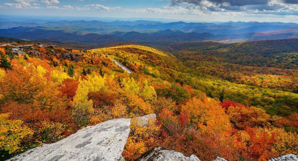
In our experience, a weekday departure in early October gives you the best mix of color and campsite availability.
Fall color on the Parkway doesn't happen all at once — it rolls downhill. Higher elevations like Mount Pisgah at 4,980 feet can start turning in late September while Otter Creek, under 800 feet, is still green. Pick your campground dates by elevation if you want peak color from your campsite.
Fall (late September-late October): Peak season. Some of the most spectacular driving on the East Coast, and the most competitive booking window. Reserve campgrounds up to six months ahead on Recreation.gov. Weekdays are significantly less crowded than weekends, and some campgrounds still have midweek FCFS availability even in October.
Summer (June-August): Open campgrounds and both roads are fully in season. Warm at lower elevations, comfortable at 3,000+ feet. Busy weekends, especially near Asheville and Boone. Afternoon thunderstorms are common but brief.
Spring (April-May): Wildflower season along Skyline Drive — more than 850 wildflower species grow in Shenandoah. Shenandoah campgrounds open between late March and late April; Parkway campgrounds open in late May. Thinner crowds, cooler mornings.
Winter: Sections of both roads close during ice and snow. Shenandoah campgrounds close by late November. Not recommended for RV travel — road closures are unpredictable and services disappear.
How do you plan the logistics of a Shenandoah-to-BRP road trip?
No hookups at any of the NPS campgrounds catches first-timers off guard. We've heard from more than one renter who planned four straight nights of dry camping and ran short on fresh water by night three. The veteran move: alternate between NPS dry camps for the scenery and a private full-hookup park near Roanoke or Asheville to recharge batteries, fill water, and run the laundry. Two or three nights dry, one night plugged in, repeat.
Starting points: DC to Front Royal (Shenandoah north entrance) is roughly 75 miles, about 1.5 hours depending on traffic. Richmond to Rockfish Gap is roughly 100 miles, under 2 hours. Charlottesville to Rockfish Gap is about 30 minutes — the closest city to the junction of both roads.
Trip length: Three days minimum for Shenandoah alone. Five to seven days covers the Virginia section of both roads comfortably. Ten to fourteen days for the full 574 miles to Cherokee.
Resupply towns: Front Royal and Luray (Shenandoah), Waynesboro (junction), Roanoke (BRP Virginia), Boone and Blowing Rock (BRP North Carolina), Asheville (southern BRP). Most are a short detour from the road.
Dry camping basics: Monitor your RV electrical system — no hookups means your house batteries are the only power source until you plug in again. Run the generator sparingly during allowed hours. Fill water at dump stations before they close for the day. Every NPS campground on both roads has a dump station except Lewis Mountain.
Check our Virginia campgrounds page for private parks with full hookups along the route.
About this guide
This guide was researched and written by the Outdoorsy editorial team. Campground details come from the NPS Shenandoah campgrounds and Blue Ridge Parkway camping pages, tunnel clearances from the NPS tunnel heights page, campground rules from NPS Shenandoah regulations, and elevations from National Parks Traveler. Driving tips also draw on conversations with Outdoorsy hosts and renters. We have no commercial relationship with the businesses mentioned unless explicitly noted. Fees, dates, and closures checked against NPS sources as of October 20, 2026.